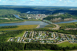
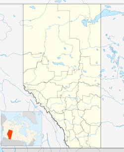
Fort McMurray
| Urban Service Area of Fort McMurray | |||
|---|---|---|---|
| — Urban Service Area — | |||
 |
|||
|
|||
| Motto: We Have The Energy | |||
 Urban Service Area of Fort McMurray
|
|||
| Coordinates: | |||
| Country | |||
| Province | |||
| Region | Northern Alberta | ||
| Census division | 16 | ||
| Specialized municipality | R.M. of Wood Buffalo | ||
| Settled | 1870 | ||
| Government[1] | |||
| - Mayor | Melissa Blake | ||
| - Governing body | Wood-Buffalo Municipal Government - Ward 1 | ||
| - MP | Brian Jean | ||
| - MLA | Guy Boutilier | ||
| Area | |||
| - Total | 35 km2 (13.5 sq mi) | ||
| Elevation | 370 m (1,214 ft) | ||
| Population (2007 official)[2] | |||
| - Total | 63,676 | ||
| - 2008 unofficial[3] | 72,363 | ||
| Time zone | MST (UTC−7) | ||
| - Summer (DST) | MDT (UTC−6) | ||
| Postal code span | T9H to T9K | ||
| Area code(s) | +1-780 | ||
| Highways | Highway 63 | ||
| Waterways | Athabasca River Clearwater River |
||
| Website | R.M. of Wood Buffalo | ||

Fort McMurray is a large hamlet in Alberta, Canada within the Regional Municipality (R.M.) of Wood Buffalo that is recognized as an urban service area.[4][5] Fort McMurray, previously incorporated as a city on September 1, 1980, became an urban service area when it amalgamated with Improvement District No. 143 on April 1, 1995 to create the Municipality of Wood Buffalo (which was later renamed to the R.M. of Wood Buffalo on August 14, 1996).[6] Despite its current official designation of urban service area, many locals, politicians and the media still refer to Fort McMurray as a city.
Contents |
History
Before the arrival of Europeans in the late 18th Century, the Cree were the dominant First Nations people in the Fort McMurray area. The oil sands were known to the locals and the surface deposits were actually used to waterproof their canoes. In 1778, the first of the European explorers, Peter Pond, came to the region in search of furs as the European demand for this commodity at the time was strong. Peter Pond explored the region further south along the Athabasca River and the Clearwater River, but chose to set up a trading post much farther north by the Athabasca River near Lake Athabasca. However, his post closed in 1788 in favour of Fort Chipewyan, now the oldest continuous settlement in Alberta.[7]
In 1790, the explorer Alexander MacKenzie made the first recorded description of the oil sands. By that time, trading between the explorers and the Cree was already occurring at the confluence of the Clearwater and Athabasca Rivers. The Hudson's Bay Company and the North West Company were in fierce competition in this region. Fort McMurray was established there as a Hudson's Bay Company post by 1870, and continued to operate as a transportation stopover in the decades afterwards.
The community has played a significant role in the history of the petroleum industry in Canada. Oil exploration is known to have occurred as early as the early 20th Century, but Fort McMurray's population remained very small, no more than a few hundred people. By 1921 there was serious interest in developing a refining plant to separate the oil from the sands. Alcan Oil Company was the first outfit to begin bulk tests at Fort McMurray. The nearby community of Waterways was established to provide a terminus for waterborne transportation, until 1925, when the Alberta and Great Waterways Railway reached there.
Abasands Oil was the first company to successfully extract oil from the oil sands through hot water extraction by the 1930s, but production was very low. Fort McMurray gradually grew to over 1,100 bpd by World War II, and Fort McMurray was set up by the US and Canadian forces as staging ground for the Canol project.
Fort McMurray and Waterways amalgamated as the village of McMurray (the "Fort" was dropped until 1962, when it was restored to reflect its heritage) by 1947, and became a town a year later. Fort McMurray was granted the status of new town so it could get more provincial funding. By 1966, the town's population was over 2,000.
In 1967, the Great Canadian Oil Sands (now Suncor) plant opened and Fort McMurray's growth took off afterwards. More oil sands plants were opened up, especially after 1973 and 1979, when serious political tensions and conflicts in the Middle East triggered oil price spikes. The population of the town reached 6,847 by 1971 and climbed swiftly to 31,000 by 1981, a year after its incorporation as a city.
The city continued to grow for a few years even after the oil bust caused by the collapse in world oil prices and the National Energy Program, which was scrapped after the Progressive Conservative Party formed the Government of Canada in 1984. The population peaked at almost 37,000, just before it declined to under 34,000 by 1987. Low oil prices since the oil price collapse in 1986 slowed the oil sands production greatly, as oil extraction from the oilsands is a very expensive process and lower world prices made this uneconomical. However, the oil price increases since 2003 have made oil extraction profitable again.
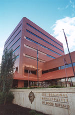
On April 1, 1995, the City of Fort McMurray and Improvement District No. 143 were amalgamated to form the Municipality of Wood Buffalo. The new municipality was subsequently renamed to the Regional Municipality (R.M.) of Wood Buffalo on August 14, 1996.[6] As a result, Fort McMurray was no longer officially designated a city. Instead, it was designated an urban service area within a specialized municipality. The amalgamation resulted in the entire R.M. of Wood Buffalo being under a single government in which Fort McMurray is the municipal seat.
In the Canada 2006 Census, Statistics Canada recorded a population of 47,705 in Fort McMurray.[8] The same year however, the R.M. of Wood Buffalo counted a population of 64,444 in its municipal census, which included a shadow population of 2,301 living in hotel/motel and campground accommodations.[9] The discrepancy in the results was attributed to differences in census methodologies where Statistics Canada used a de jour method while the municipality used a de facto method.[10]
Geography
Fort McMurray is 435 kilometres (270 mi) northeast of Edmonton on Highway 63, about 60 kilometres (37 mi) west of the Saskatchewan border, nestled in the boreal forest at the confluence of the Athabasca River and the Clearwater River. It is located 370 metres (1,214 ft) above sea level. Fort McMurray is the largest community in the Regional Municipality of Wood Buffalo.
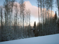
White spruce, trembling aspen, balsam poplar and white birch are the most prominent native trees in and around town. Black spruce and tamarack occur in poorly drained areas and jack pine may be seen on the driest sites. European aspen, blue spruce and sand cherry are among the exotic trees occasionally seen.
Climate
Fort McMurray has a borderline humid continental climate (Koppen climate classification Dfb, just above a subarctic climate), with long, very cold winters and fairly warm but short summers. The town lies at a lower elevation than most other parts of Alberta, so under the right conditions it can be a 'hot spot' for Alberta or even all of Canada (as in April 1980 when its daily mean temperature of 10.0°C was unsurpassed by any other Canadian station). Temperatures average -19°C in winter with the lowest recorded -50.6°C, (-58°F).[11] In July temperatures average 17°C, with the highest recorded being 37°C in August.[11] Its annual precipitation amounts to 455.5 millimetres (17.9 in) and falls mainly in the summer months, its snowfall is 155.8 centimetres (61.3 in)[11] and appears within a range of 5 to 7 months.
| Climate data for Fort McMurray | |||||||||||||
|---|---|---|---|---|---|---|---|---|---|---|---|---|---|
| Month | Jan | Feb | Mar | Apr | May | Jun | Jul | Aug | Sep | Oct | Nov | Dec | Year |
| Source: Environment Canada[12] | |||||||||||||
Economy
Fort McMurray is considered the heart of one of Alberta's (and Canada's) major hubs of oil production, located near the Athabasca Oil Sands. Besides the oil sands, the economy also relies on natural gas and oil pipelines, forestry and tourism. The two largest oil sand mining companies are Syncrude and Suncor Energy.
Fort McMurray's growth is characteristic of a boomtown.[13]" Housing prices and rents are far higher in Fort McMurray than one would expect in such a remote area. In 2006, Fort McMurray had the highest prices in Alberta.[14] The Albertan government has promised to release more Crown land for residential construction, particularly in Timberlea on the north side.
Demographics
| Census History |
|
| Year | Population |
|---|---|
| 1951 | 926 |
| 1961 | 1,186 |
| 1971 | 6,847 |
| 1981 | 31,000 |
| 1991 | 34,706 |
| 2001 | 38,667 |
| 2006 | 47,705 |
The official population of Fort McMurray is currently 63,676,[2] which includes 62,589 permanent residents counted by the R.M. of Wood Buffalo's 2007 municipal census[2][15] and the 1,087 non-permanent residents counted by Wood Buffalo's 2009 shadow population update.[2]
Although the R.M. of Wood Buffalo's 2008 municipal census presented Fort McMurray's population as 72,363 (70,304 permanent and 2,059 non-permanent residents),[3] the overall 2008 municipal census result for the R.M. of Wood Buffalo was not accepted as an official population by Alberta Municipal Affairs due to the use of statistical extrapolation instead of 100% door-to-door enumeration.[16][17] Therefore, Fort McMurray's 2008 population is considered unofficial.
Fort McMurray experienced an average annual growth rate of 9.9% between 1999 and 2007.[15] Forecasts from the R.M. of Wood Buffalo's Strategic Planning and Policy Division project that it will reach a population of 100,000 by 2012.
Fort McMurray is a multicultural community, attracting people from all corners of Canada and the world. Albertans make up almost half the number of migrants to Fort McMurray, followed by 17% of people originating from the province of Newfoundland and Labrador.
If Fort McMurray were still incorporated as a city, it would be the fifth largest in Alberta (after Calgary, Edmonton, Red Deer and Lethbridge).
Notable McMurrayites
- Chris Phillips, ice hockey player, Ottawa Senators
- Scottie Upshall, ice hockey player, Phoenix Coyotes
- Nolan Pratt, ice hockey player, Buffalo Sabres
- Colin Murphy, ice hockey player, Portland Pirates (AHL)
- Aaron Lines, singer
- Natasha Henstridge, actress
- Tantoo Cardinal, actress
- Justin Pogge, ice hockey player, San Antonio Rampage (AHL)
Infrastructure
Transportation
- Air
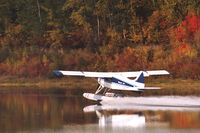
Fort McMurray Airport (ICAO Code CYMM, IATA Code YMM) is serviced by Air Canada, Air Canada Jazz, Air Mikisew, Integra Air, McMurray Aviation, Northwestern Air and WestJet with scheduled flights to Calgary, Edmonton, Fort Chipewyan, Fort Smith, Lethbridge, Peace River, Saskatoon, Toronto and St. John's. The airport is also serviced by various oil companies with corporate and charter flights. Flights are frequently booked to capacity because of the high transient worker population and people unwilling to drive on Highway 63.
- Public transit
Fort McMurray Transit (FMT) operates in the community, with routes that extend to all subdivisions on the south side and most of the subdivisions on the north side.[18]
- Bus
Greyhound Canada and Red Arrow operate scheduled passenger bus services to Edmonton and other communities along Highway 63, as well as other destinations further south.
- Highways and roads
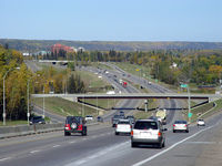
Highway 63 is the only highway between Fort McMurray and Edmonton. Due to the industrial demands of the oilsands, Highway 63 boasts some of the highest tonnage per kilometer in Canada, and the largest and heaviest loads that trucks have ever carried. Construction to twin Highway 63[19] have been announced by the Government of Alberta with twinning set to began in the summer of 2007. Highway 881 also provides access to the region from Lac La Biche.[20] Fort McMurray is also served by Highway 69, a short spur off of 63 that connects Fort McMurray with its airport and a few rural residential developments to the southeast.
- Rail
Canadian National Railway operates a rail line between Fort McMurray and Edmonton, and Canadian Pacific Railway has proposed building a new high-capacity line to the area. CN discontinued the Muskeg Mixed (mixed train) to Fort McMurray in 1989, and there has been no passenger rail service since.
Education
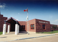
The Fort McMurray Public and Catholic School Districts both serve the Primary, Elementary, and Secondary Education needs of students in Fort McMurray.
Based in the Abasand subdivision, Centre Boréal Francophone School serves the needs of Francophone students in the area.
Keyano College is a publicly funded college and vocational institute based in the area known for both its Musical Instrument Repair diploma as well as for its role in training workers for the Oil Sands. Known as the cultural hub of the Regional Municipality of Wood Buffalo, Keyano College contains both a state-of-the-art theatre and recital hall, hosting a variety of musical and theatrical events that attract upwards of 50,000 visitors each season.
Media
See also
- Keyano College
- Oil sands
- Peter Pond
References
- ↑ Regional Municipality of Wood Buffalo. "Municipal Government". http://www.woodbuffalo.ab.ca/municipal_government/index.asp. Retrieved 2007-06-23.
- ↑ 2.0 2.1 2.2 2.3 Alberta Municipal Affairs (2009). "2009 Official Population List". http://www.municipalaffairs.gov.ab.ca/documents/LGS/2009pop.pdf. Retrieved February 15, 2009.
- ↑ 3.0 3.1 R.M. of Wood Buffalo (July 15, 2009). "2008 Municipal Census Report". http://www.woodbuffalo.ab.ca/business/demographics/pdf/2008_municipal_census.pdf. Retrieved February 14, 2009.
- ↑ Alberta Municipal Affairs (2010-04-01). "2010 Municipal Codes". http://municipalaffairs.gov.ab.ca/documents/msb/2010code.pdf. Retrieved 2010-07-19.
- ↑ Alberta Municipal Affairs (2010-04-01). "Specialized and Rural Municipalities and Their Communities". http://municipalaffairs.gov.ab.ca/documents/msb/2010-ruralmun.pdf. Retrieved 2010-07-10.
- ↑ 6.0 6.1 Alberta Municipal Affairs (2010-02-05). "Location and History Profile – Regional Municipality of Wood Buffalo". http://www.municipalaffairs.alberta.ca/cfml/MunicipalProfiles/index.cfm?fuseaction=BasicReport&MunicipalityType=SMUN&stakeholder=508&profileType=HIST. Retrieved 2010-02-08.
- ↑ The History of Fort McMurray
- ↑ Statistics Canada (Census 2006). "Population and dwelling counts, for Canada, provinces and territories, and urban areas, 2006 and 2001 censuses - 100% data". http://www12.statcan.gc.ca/census-recensement/2006/dp-pd/hlt/97-550/Index.cfm?TPL=P1C&Page=RETR&LANG=Eng&T=802&SR=1&S=1&O=A&RPP=9999&PR=48&CMA=0. Retrieved 2010-07-19.
- ↑ Regional Municipality of Wood Buffalo (2006). "Municipal Census 2006". http://www.woodbuffalo.ab.ca/business/demographics/pdf/2006_census.pdf. Retrieved 2010-07-19.
- ↑ Fort McMurray Today (2007-03-13). "Census comes up short". http://www.fortmcmurraytoday.com/ArticleDisplay.aspx?archive=true&e=1828309. Retrieved 2010-07-19.
- ↑ 11.0 11.1 11.2 "Canadian Climate Normals 1971-2000". Environment Canada. http://www.climate.weatheroffice.ec.gc.ca/climate_normals/results_e.html?Province=ALL&StationName=fort%20mcmurray&SearchType=BeginsWith&LocateBy=Province&Proximity=25&ProximityFrom=City&StationNumber=&IDType=MSC&CityName=&ParkName=&LatitudeDegrees=&LatitudeMinutes=&LongitudeDegrees=&LongitudeMinutes=&NormalsClass=A&SelNormals=&StnId=2519&&autofwd=1. Retrieved 2008-01-20.
- ↑ Environment Canada—Canadian Climate Normals 1971–2000, accessed 06 July 2009
- ↑ Daily Telegraph Article, Saturday Magazine-15/9/07
- ↑ Edmonton Journal - prices in Fort McMurray
- ↑ 15.0 15.1 R.M. of Wood Buffalo (2007). "2007 Municipal Census Report". http://www.woodbuffalo.ab.ca/business/demographics/pdf/2007_census_RMWB.pdf. Retrieved February 14, 2009.
- ↑ R.M. of Wood Buffalo (July 15, 2009). "Wood Buffalo’s population passes 100,000, reports 2008 Municipal Census". http://www.woodbuffalo.ab.ca/municipal_government/media_releases/2009/july15.census.asp?subnav=161. Retrieved February 14, 2009.
- ↑ Fort McMurray Today (July 16, 2009). "Wood Buffalo hits 100,000, but province not paying up". http://www.fortmcmurraytoday.com/ArticleDisplay.aspx?archive=true&e=1659629. Retrieved February 15, 2009.
- ↑ Transit website
- ↑ [1]
- ↑ Fort McMurray Tourism. "Fort McMurray Tourism". http://www.fortmcmurraytourism.com/. Retrieved 2008-01-30.
External links
- Regional Municipality of Wood Buffalo
- Oil-sands Boomtown - CNN Money Video Added on July 9, 2008
 |
Wood Buffalo National Park | Fort Mackay | |
|
| Wabasca | La Loche | |||
| Athabasca | Lac La Biche | Cold Lake |
|
||||||||||||||